Search the Community
Showing results for tags 'gps'.
Found 19 results
-
 My new Q2 doesn't have Bluetooth On/Off. It only is off. I've reset the camera twice but it still is missing. And there isn't anything regarding GPS shown in the menus. When trying to pair it only gives option to press "SET" to abort. I have my LG phone and iPad setup with the FOTOS application and ready to pair/sync. but they can't find the camera because I can't turn Bluetooth ON. Help required. thanks guys.
 -
Nachdem ich schon lange passiv hier umschleiche, habe ich am Dienstag meine M11 bei Meister in München abgeholt. Daneben habe ich schon länger eine M6 um den Hals. So nun zu meiner Frage: Meine M11 tagged alle Bilder mit den Koordinaten 0/0, also irgendwo im Meer vor dem afrikanischen Kontinent. Das ist insofern umständlich, da ich erst diese sinnfreie Koordinate löschen muss, um dann in Lightroom mit meinem GPS Track die richtigen GPS Koordinaten zuzuweisen. Kann man das umgehen? Über die Photos App geht das GPS tagging ja wohl noch nicht.
-
Moin in die Runde, wer kann mir erklären, wie das bei der SL2 jetzt mit den Geo-Daten funktioniert? Das bei der SL ein kleiner Mangelpunkt existierte ist bekannt und in der Vergangenheit hier im Forum abgehandelt worden. Leica hat daraus gelernt und bei der SL2 den GPS gar nicht mehr integriert, damit schon einmal "mein Generve" abgestellt. Habe ich verstanden und ist auch soweit ok. Aber wie funktioniert das jetzt für Outdoor-Nutzer in der Praxis mit der SL2. Habe ich das richtig verstanden: Ein Handy mit GPS immer so dabei haben, dass es immer GPS-Empfang hat, also nicht tief im Rucksack Immer eine WLAN oder BT Verbindung mit der SL2 halten (lutscht bei beiden Geräten ordentlich Akku meine ich) Werden die Daten nur bei Auslösen mit dem Handy übernommen, oder auch beim Auslösen mit der SL2? Oder werden die Daten nur beim Übertragen von der SL2 auf das Handy, mittels Leica-App übernommen, wenn ich nicht Übertragen möchte, sind keine Daten in den DNGs oder JPGs? Bei DNG-Übertragung mittels Leica-App muss man das jährliche Abo für knapp 60.- abschließen, finde ich auch eher beschämend. Wer hat das mit der SL2 schon gemacht und kann mich "entdummen"? Viele Grüße Buggi
-
Hi, I am new to the S system (S3) and I have yet to get a GPS lock when outdoors. The camera's GPS function is enabled (On) in the menus and the satellite indicator appears in the top LCD screen with an X, indicating no lock (and I can confirm no GPS metadata in image). Are there any known issues I should be aware of and, if not, how long does it typically take to get a GPS lock assuming open field with no line of site issues? I've searched the forum and found some GPS related post cover time sync problem, but I'm getting nothing. I'm not getting a lock in the same locations that I would get a fast (<10-15s) using my 1Dxii. Any help appreciated, Thanks! -Roland.
-
 Hello fellow reddoters Is any improvement in GPS functioning after last firmware? Last time, i was checking it was terribly laggy and sometimes exif misses geotag info. This made a MFG simple useless for me 😐 Regards.
 -
Has anyone else had any problems connecting the GPS to the M10 Monochrom? Most of the time, I see in the rear screen that the GPS icon has an "x" through it...obviously not connected. I have the Visoflex connected to the camera and the GPS turned on in the menu. I realize there are areas that pose a problem for GPS connections, but I have tried various types of environments. Am I missing something? I've only had it connect sporadically over the past few weeks. Thanks.
-
I just got a Q2 and I'm trying to add GPS data to images. Can anyone confirm the following? I just want to be sure. There is no on-camera GPS functionality with the Q2 GPS data is only added to photos that are taken remotely with the Leica Fotos app. Specifically, there is no way to connect to one's device (iPhone, etc.), leave it open, and have the connected Q2 retrieve GPS data while one takes photos with the camera Adding GPS data does not require the "pro" version of the app. GPS is stripped from the small preview the non-pro version allows one to share. Thanks, John
-
Hallo und guten Abend! kann mir jemand sagen, wie ich die Geodaten in meine EXIF bekomme? Wird ja in dem Update der Fotoapp als neue Funktion angezeigt - aber egal was ich mache - ich bekomme keine GPS-Daten in die EXIF! Habe die alte App gelöscht (IOS) und die neue heruntergeladen. Wenn ich die App und die Kamera (Q2) einschalte, dann wird WiFi-Verbindung zur Fernbedienung der Kamera hergestellt - was ich ja eigentlich gar nicht möchte. Schalte ich jetzt mit der Kamera die WiFi-Verbindung aus, dann kommen keine GSP-Daten - ich hab schon alles versucht! Was mache ich falsch?? Danke für Eure Hilfe! Viele Grüße Sonja
-
Ich hoffe diese Rubrik ist die richtige für meine Anfrage. Ansonsten bitte gerne in die richtige verschieben. Wenn ich durch die Gegend fahre und einen netten Ort sehe den ich fotogen finde, habe ich mir seit kurzem angewöhnt mit meinem Smartphone (Android HTC) ein Bild zu schiessen und mittels der GPS Koordinaten in google Maps einen Ort zu definieren und mit einem Label zu benennen. Das ganze mache ich um später wenn ich mit der Kamera unterwegs bin oder ich mir besseres Wetter, Licht Tageszeit etc. verspreche, den Ort wieder zu finden. Allerdings ist das ganze in Google Maps nicht sehr einfach zu handhaben und die Verwaltung der "Locations" mittels Labels ist alles andere als einfach. Man erhält ne Liste mit kruden GPS Koordinaten und wenn ich das Handyfoto als Erinnerungstütze einfügen will wird das ganz öffentlich geschaltet. Abgesehen davon finde ich, das das kein intuitives Bedienungskonzept ist. Insgesamt sehr holprig das ganze, und die interessanten Trampelpfade sind einfach auch oft nicht in Google Maps verzeichnet. Google ist ja nicht so fürs "Outback"... Ich hätte gerne eine App in der topografische offline Karten hinterlegt sind auf denen ich mir einen Merker setzen kann, auch wenn ich gerade keinen Internet Empfang habe und bei dem Merker noch ein Handyfoto einfügen kann. Diese Merker sollten am besten noch in Ordner/Rubriken sortierbar sein und die Merker auch noch einfach zu verwalten sein. So wie Lesezeichen in einem Browser. So habe ich z.B. alle Merker aus Dänemark zusammengefasst. Oder alle Merker an der Nordsee. Wenn das Ganze dann noch mit meinem MAC zusammenarbeitet wäre das super. Am Großen Monitor plant sich ne Fototour doch schöner... Hat da jemand einen Tipp? Gibt es solche Kartenapps (Die topografischen Karten sollten für Europa zu erwerben sein und auch geupdatet werden) bei denen mann seine eigenen Sehenswürdigkeiten speichern kann und auch noch Fotos hinterlegen kann? Und das ganze möglichst nicht nur Cloud basiert sondern auch offline funktionierend? Vielen Dank im Voraus…
-
Does anyone know if it's possible to GPS tag images by using a smartphone's GPS? In theory it should be: M10 connected to iphone via Bluetooth iPhone sends GPS info to M10 M10 adds this to the exif of each image I bought the EVF solely for GPS; but now I'm thinking of returning it, because it blocks the shutter dial partially, and just isn't in line with how a rangefinder is supposed to be used (and I would never use the EVF), in my opinion. But connecting through a smartphone makes sense and is far more elegant.
-
Habe ein interessantes Problem bei meiner S (Typ006) entdeckt: Bei meinem Bildverwaltungsprogramm (Apple Photo) werden bei einigen Bildern als Orte Aufnahmen in Griechenland, genauer gesagt im Ionischen Meer angezeigt. Beim Aufrufen zeigt es sich, dass die Bilder aus dem Norden von Österreich stammen. Ich kann mich erinnern, dass die Fotos aus einer Serie stammen, die ansonsten richtig zugeordnet sind. Das war im letzten Jahr, mir ist das vorher nicht aufgefallen, da meine Bilder nach Datum sortiert werden und ich sie auch nach Datum suche.
-
Lately I have had problem with the Leica SL GPS in Lightroom CC. No coordinates seems to be recorded. As I have the same problem with the Hasselblad X1D I searched for a "solution". Actually the files (X1D or SL) can be opened in Hasselblads Phocus (free) software. Here the coordinates appear and can be shown in Google Earth with Command +alt +m. A Lightroom CC bug? Or user incompetence?
-
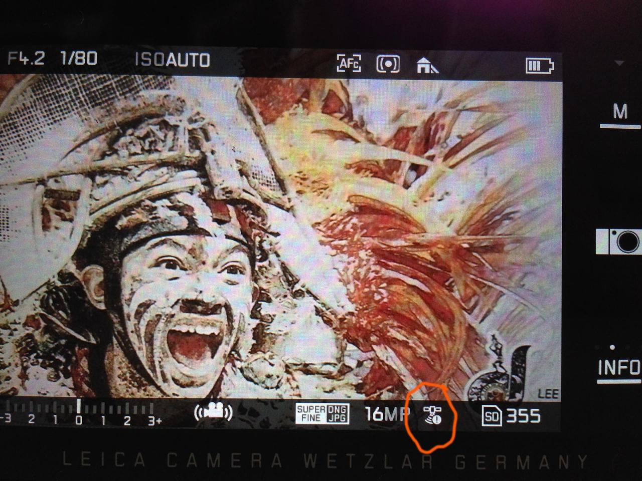
Hello! I have just notice the small "!" with the GPS icon on the menu bar. What does it mean? GPS can not find your location perhaps? Does that indicate a malfunction? Tried reseting the camera; reinstalling firmware; GPS still indicates "!" when turned on. Thank you so much for your kind assistance.

-
Ich bin mit meiner Leica T sehr zufrieden. Bilder sind brillant. Leider hat das GPS Modul einen Fehler. Anfangs funktionierte die Aufzeichnung sehr gut; alle Bilder hatten GPS Daten. Neuerdings (Version 1.5) wird bei keinem der Bilder mehr GPS Daten aufgezeichnet. Ich kann einstellen, was ich will. Die Kamera zeigt im unteren Info Feld auch das GPS Symbol mit einem Ausrufezeichen an.
-
Hello fellow users, I have seen a longer thread about the GPS "performance" in the handgrip. I got one of them, because I wanted to do some UBS connected shooting (macro and micro). Today I was out and switched the GPS function on - it took about 45 minutes until the GPS function started to work. It was downtown Vienna, in streets - but my Holux GPS does this in about 1 or 2 minutes. Is this normal? Would it make sense to send the grip to Wetzlar to get it checked? I can´t believe that Leica produces such a slow responding system - what is your opinion? Thanks and regards Georg Nyman
-
Dear All, I have a nagging feeling that Leica HQ has forgotten an ignored it's digital M users! One year now and counting, and still no FW update to the digital M 240 platform cameras. There are a number of seemingly simple problems to fix, by no new FW updates for the M 240 for more than one year. I posses, and are still using most M cameras from my M3 SS (except the M5), up to and including my M P (Typ 240) and M Mono (Typ 246). I still enjoy analogue M, and they "chew" T-MAX 100 ISO 30 ft by the numbers. Fine as the M 240 is, there are a number of annoying problems that are easy to fix, but still no new FW from Leica HQ after more than one year. Have they forgotten us? But seriously, whay not fix what can be improved or polished!? One very annoying feature I encounter almost every day, is the completely imbesil control FW of the GPS MF grip, and not to mention SD card problems and EVF lockups! As an example, I went to PhotoKina last year, and stayed at a hotel (Marriott) close to the Køln Cathedral, a 25 minute walk to the PhotoKina exhibition area, a walk that is mostly in open air and in excellent view of the sky. During this walk the M 240 GPS does not manage to get a single position fix for the whole walk! After reaching the PhotoKina entrance, I had to sit down for more than ten minutes until the GPS got a position fix. Traversing the streets of Køln for four days, my images have only a few GPS position fixes. I contacted Leica about this problem, and they sent me a new GPS, only to experience the same problems thereafter. I love the M lenses and enjoy the RF experience, but this is 2015 and Leica need to take the die hard M users seriously by fixing whatever problems that can be fixed in FW in a timely manor. I realise that I am plain stupid, having spent close to 100k Euros on digital Ms and lenses since the introduction of the digital M8! But I feel left out in the dark and ignored by Leica not making the most of what it should by releasing timely updates to the M FW. Look at Fuji, they give customers a "new" camera even after several years, by issuing FW updates with new functionality! The M 240 is a great camera, but it could be so much more if Leica only wanted and recognised it's responsibility to users already invested in the system. I know that there are a lot of Leica fanboys out there that think that any change is "evil" and should note be implemented. However, I think the community og photographers that genuinely would like the M to be as usable as possible, and this can be accomplished by FM updates. I love the RF experience, but please save me from bad engineering, and fix the minor quirks, the M 240 could be a much better camera! I am not asking for autofocus or 100000 ISO, I just want a stable predictable digital M RF camera, and I think there are many others that wish for the same! Best regards Trond
-
Hi guys, New member here.... I recently bought the X-113 and a Visoflex. The Visoflex is primaily used for EVF and diopter purposes, but when something is marketed with some function, I like to test it. The Visoflex is supposed to give GPS readings. However, turning the function on and being outside with it for a few hours still does not make it function. The exclamation mark, telling me that the reading is not received, is there all the time. A couple of times I have been able to get a reading, but then only after multiple times turning the "X" off and on, removing and mounting the Visoflex, so there does not seem to be any consistency in when it will get the GPS reading. I have also been with the importer, and they don't know what is the problem, either. The problem was replicated with their Equipment as well... I understand that some "T" cameras also have suffered from this. Any other X.113 users out there who suffers from this? If we are many, maybe Leica will look into the matter....
-
Ich bin neu im Forum und habe bei meiner V-Lux30 Probleme mit der GPS-Funktion. Selbständig sucht das Gerät praktisch nie die neue Position. Erst über dem Menupunkt "Aktualisieren" sucht es die neue Position. Das dauert mindestens 3 Minuten. Das Gerät findet dann auch 3-6 Satelliten. Hat jemand ähnliche Probleme (gehabt?) und wie wurde das gelöst. Bin für jede Anregung diesbezüglich dankbar. Hatte mir die Camera extra wegen dieser Funktion gekauft und bin jetzt sehr enttäuscht . Digitale Grüße Günter Brunnert
-
hallo gibt es eine Möglichkeit die Blitzsynchronisation der V-Lux 1 bei aufgesetzem externen Gerät zu übersteuern? Konkret: der Jobo Photogps wird in den Blitzschuh gesteckt und erhält seinen Impuls fürs GPS-Tagging durch den Blitzkontakt. Wenn er jedoch aufgesetzt ist, stellt die Kamera auf 1/30s und f4 für die Blitzsynchronisation ohne TTL-Messung. Im Kamera-Menü kann ich auf manuelle Synchronisation stellen und die Blende umstellen, nicht jedoch die Zeit. Stelle ich an der Kamera den Blitz auf forciert aus, funktioniert das GPS-Tagging nicht. Hat jemand vielleicht eine Idee was sich da machen lässt?